The planning for this trip started in August 2016, and we decided that it would be a base camp trip, with day trips to the points of interest, allowing us to take our campers. (I need my comfort in my doderage and it would reduce the weight of the vehicles.)
The trip participants were three couples – Maria and Steve, in their 120 Prado towing their Vista; Julie and Trevor, in their 120 Prado towing their MDC soft floor, and Barbara and myself, in our Landcruiser 100, towing our Kimberly Kamper. We planned to meet in Cairns to start the trip on the 1st of June.
Barb and I left in the middle of May to catch up with some family members, on the way.
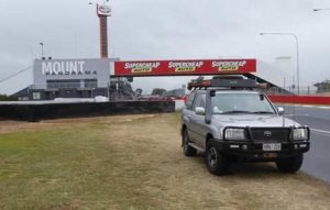
We passed through Bathurst so I just had to do a lap of Mt Panorama. Coming down Conrod Straight into the dog leg I was doing the legal speed. All of the roads that make up the racetrack are public roads and the ‘Boys in Blue’ are known to love out-of-towners who want to try out the track. Anyway, there is a suggested turning speed of 40 km/h going into the dog leg. I was doing a little more than that and damn near ran off the road. To think the racing cars are doing 160kmh at that point makes you appreciate the skill of those drivers.
After visiting our nephews and their families in Sydney, Narrabri and Brisbane, we finally started the trip north. It was just a quick transit, stopping at convenient places each night. Townsville was a definite stop – Barbara had a flight to catch back to Adelaide for a High School Reunion.
Maria and Steve turned up in the same caravan park in Townsville, so we travelled up to Cairns together. We had all planned to meet in the same caravan park in Cairns two days before the planned start date, so that we were all together before the trip and not having to worry about people not making a remote meeting place. After the final purchases of supplies, plus a pre-trip dinner on the Cairns foreshore, we were ready to depart on time on 1 June.
Week 1
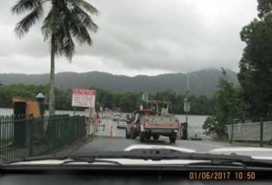
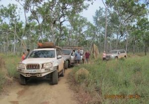
We set up the convoy by the order we happen to leave the caravan park in. This would be the order for the whole trip with the day’s leader going to the tail the next day. That way everybody got their fair share of clean, dust free air and first choice of campsites. Crossing the Daintree River on the ferry, the trip felt like it had really commenced.
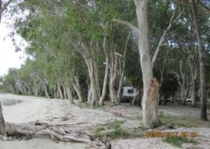
The first night was to be in the Cape Tribulation National Park.
When we arrived at the campground we found that bloody awful sign – All Camp Sites MUST be pre-booked on the Queensland National Parks Web Site before arrival. AHHHH. We were to suffer from this problem for the whole trip. This system is an absolute pain. Nobody we spoke to likes it, including the couple of Park Rangers we caught up with.
Anyway, we found a private campground, set up camp and then set off to explore the region. We had a look at the Daintree Discovery Centre, which was excellent and found that the place is run by South Australians. Leaving here, we wandered up to Cape Tribulation.
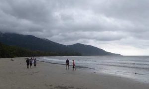
The Cape was named by Captain Cook in 1770. It was near here that all of his trouble started. His log notes “here begun all our troubles“.
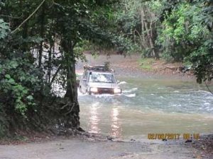
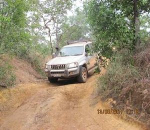
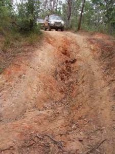
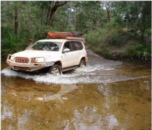
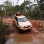
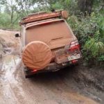
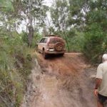
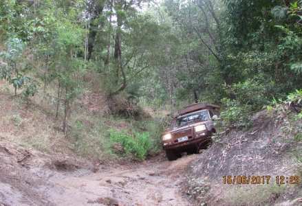
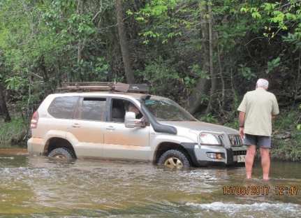
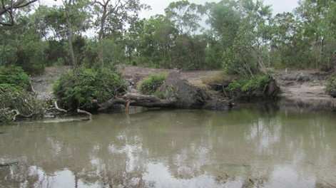
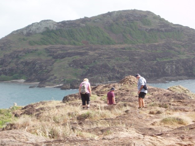
The next day we were going to travel to Cooktown via the Bloomfield Track. It rained overnight and this made travelling the track more ‘interesting’. We had our first river crossing at Emogean Creek, which was a little more than hub-cap deep. After doing the Stop, Get- out and Look and then Think, Assess and Decide (which we had to do on many occasions during the trip) we did our first relatively deep crossing without any trouble. This was the deepest crossing that a couple of us had ever done up until then. There are some incredibly steep sections on the Bloomfield. We were all in 1(H) or 3 (L) to get up them.
The track is mostly good,
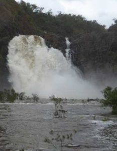
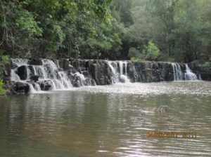
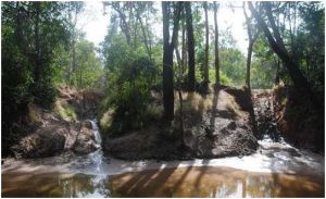
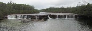
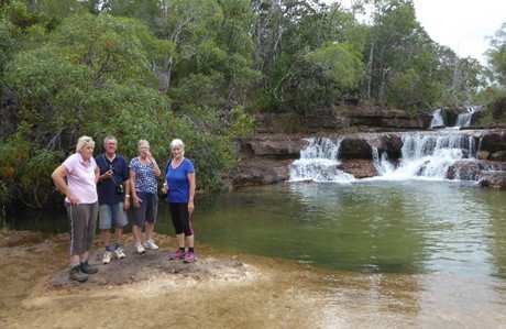
graded dirt through thick rain forest, with lots of creek crossings; the major ones have had bridges constructed across them. The very steep sections have been concreted with ribs to provide traction. We still had to use maximum power to negotiate them. After getting through the Bloomfield Track we stopped to have a look at the Bloomfield Falls near Wujal Wujal. The 40m falls were flowing quite strongly after the recent rains.
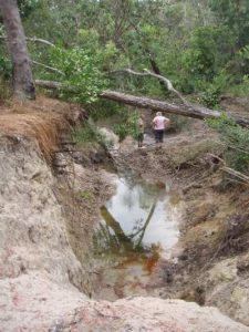
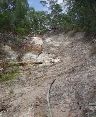
Black Mountain was the next stop, which is a mass of granite boulders, some the size of houses. The absence of soil between the boulders and rocks create a maze of gaps and passages, which can be used to penetrate inside the mountain. These rocks can become extremely hot.
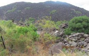
The mountain was originally formed out of magma that first slowly solidified under the Earth’s crust about 250 million years ago. The softer land surfaces above the solidified magma eroded away over time, leaving the magma’s fractured top to be exposed as a mountain of grey granite boulders blackened by a film of microscopic blue-green algae growing on the exposed surfaces. Colder rains falling on the dark, heated granite boulders causes the boulders to progressively fracture, break, and slowly disintegrate, sometimes explosively.
There is very little at Archer Point other than a light house and a rudimentary camp site behind the dunes. The turning circle at the light house was basically non-existent so I had to do a 20 point reverse turn with the trailer. It was also very windy. We found a campsite where the wind was nowhere near as strong. The tuna sandwiches were not a substitute for the schnitzel on which I had planned.
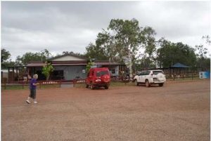
From Archer Point we headed on to Cooktown where we planned to spend a few days. We booked into the campground, set up and then set off to explore the district. Due to our different interests, we decided would split up and do our own thing, here.
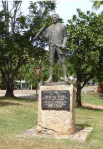
Before it was called Cooktown, it was here, in July 1770, Captain James Cook (actually Lieutenant at that time) had to beach his ship the Endeavour to repair the ship’s hull.
We spoke to an Aboriginal Elder that we just happened upon who told us that Cook was extremely lucky that he had chosen that specific spot on the river to do the repairs. The local tribes used that particular place as a neutral area between the local tribes for discussions and ceremonies. If Cook had chosen any other place on the river, in all probability, the whole crew would have been killed because they were trespassing on tribal land.
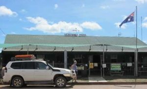
Cooktown was developed in 1873 as the service port for the Palmer River gold fields and the local area that was just starting to be developed. In its heyday there were 94 hotels, numerous brothels and a population of 30,000. Today the permanent population is about 1600; and a huge number of itinerant tourists.
The group’s first port-of-call was to the National Parks office to organise e-permits and pre-pay for campsites in Lakefield National Park. What a shemozzle! The National Parks web system was hopeless and the web kept dropping out as well.
The office staff were not supposed to offer assistance but, after 1 ½ hours of the 6 of us trying to negotiate the system, they took pity on us and rang the e-permit people on the “staff secret phone number” only to be told that the system was down and we could not book – and to ”come back tomorrow”. We dually went back the next day to be told that an Aboriginal Elder had died and the park was closed until August!!!
That meant we had to devise a plan “B”, which wasn’t difficult; but Lakefield is a spectacular area and we were going to miss it. Bugger! (We found out later that only a small section of the park had been closed.)
The on-line booking system is a major aggravation. It has taken all spontaneity out of travelling. You have no idea if your rig will fit on a site when you book. It causes many arguments when people arrive at campsite to find their site occupied and in the more out of the way places, there is no web or phone access to be able to book. However, the ‘bright young bureaucrats’ love it. Of course, they don’t do the type of travel we do and don’t have to use their blasted system. AND… South Australia National Parks has jumped on the bandwagon and PROUDLY announced that, we too, can now only pre-book campsites on their website.
Well, that’s my whinge for this section!
There are several worthwhile museums in Cooktown. The standout is the James Cook Museum, which we visited. You can learn about the USA Airforce activities in the area, during the WW2 conflict.
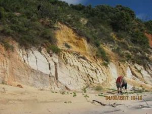
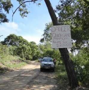
The next day (4th of June) the group planned to visit the Elim Beach and its coloured sands. That night it rained! We left early because it was about 200 km round trip. To access Elim Beach you have to obtain a permit from the Hope Vale Service Station. Hope Vale is an Aboriginal Community and, given that it was Sunday, we were not sure that we would be able to get a permit. We reached Hope Vale and watched 10 kids climb out of a Troopy and go into the local church, then purchased our permits and continued to Elim Beach.
The Elim Beach campground is fantastic. It would be well worth a few days stay; right on the beach with creeks flowing through, well protected from the prevailing winds. To get to the coloured sands involves a bit of beach driving across the outlet of one of the creeks. There is a sign warning people about the dangers of being bogged in the quicksand. We all made the quicksand crossing without problems and then drove the 2km on the beach to the area we had come to investigate.
On the way back to Cooktown we stopped at the Isabella Falls and the Endeavour Falls.
The following day was spent doing laundry and some minor repair work to the vehicles and campers. During the afternoon, we visited some Cooktown tourist sites. One of the sites is Grassy Hill, just at the back of the town. This is the highest point around the town and was the site of a radar station during WW2. It’s also from where Cook worked out how to get through the labyrinth of reefs to access the open ocean.
June 6 dawned with heavy overcast skies, after a night of continuous rain – a very wet pack up. Because we couldn’t camp in Lakefield National Park, we decided to take Battle Camp Road to Laura and free camp along the Peninsula Development Road. We were on the road by the normal start time of 8:30 and just tootling along looking for a morning tea stop when our Tyre Pressure Monitor started to sound off. Bugger! Pulled over to find a split in the sidewall of the rear passenger side tyre. Double Bugger!
One of the benefits of travelling with a group there is always assistance at hand to help with these things. We jacked the car up, put the spare on and then attempted to do an emergency repair by plugging the split. After inserting 4 plugs there was still a loud hissing noise when we attempted to put some pressure in the tyre. Triple Bugger! Fortunately, we always carry a spare, off-the-rim tyre, on the roof so we did not have any concerns.
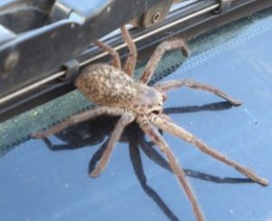
We stopped for a look at the Old Laura Homestead on the way. Getting back into the vehicle, a beastie dropped down from the roof rack. Scared the hell out of me.
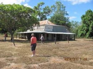
We had to get a new tyre in Laura at the General Store. The General Store was the like something out of the Dad ‘n’ Dave series. The only tyre of our size, actually the only brand of tyres sold, was some Chinese brand that we had never heard of. Beggars can’t be choosers, so we bought it. We decided to put the roof spare carcass on the spare rim and the Chinese tyre on the roof as the back-up spare. It took the bloke, who would have been 80 if he was a day, an hour and a half to fit the tyre: all done by hand. Seems the roof spare had become a little distorted because it was resting on its side, while tied down on the roof rack. So, $350 later, we were on our way again.
Starting up the PDR the corrugations started – continuous, horrible, awful corrugations. Fellow travellers, heading south, told us that the road from Laura to the Musgrave Roadhouse was not good. They were right.
When travelling, we start to look for a campsite about 3:00. If you leave it later, then most of the sites are full to overflowing. We planned to find a free camp for the night and found a reasonable spot alongside a Telstra tower just near the Hann River; unfolded the very wet campers and settled down for a ‘lemonade’ and a chat before tea and an early night.
Week 2
Up early, packed up the now dry canvas (thank God) and were on the road early to head towards Chilli Beach. After waiting in line for 35 minutes we all fuelled up at Musgrave Roadhouse at $1.59 per litre, then on to Coen for lunch. We were told the corrugations were not so severe after the roadhouse – HA!
Explored the main street of Coen – all 300m of it; had a look at the General Store and its display of ‘unique’ mining equipment and the more formal Historical Society Museum. The HSM has a huge display of old steam engines and other mining paraphernalia. The three blokes enjoyed it anyway.
Lunch was at the free camping area just out of town. Great spot to camp but we were a little early so decided to push on. (The 2015 Club trip stayed here.) After lunch, back on the PDR and more dust and corrugations.
From Coen, we travelled up to Archer River Roadhouse and invested in an ice cream. We had heard about the Archer River Burgers but the queue was just too long (a 30 minute wait). After this, we headed for Chilli Beach to find a campsite, turning off the PDR onto the road that leads to Lockhart River, Portland Roads and Chilli Beach. After a couple of kms, we found a disused quarry and set up for the night.
The next day we intended to head to Lockhart River for a night in the caravan park. Alas, there was no caravan park. Oops! A bit of poor planning there. We stopped at the Lockhart River Ranger Station to attempt to book Chilli Beach Campground via the Qld National Park Website. At the Rangers Station, there is a screen and keyboard to do just that – with a sign, “This is a very slow connection. Please be patient.” Our patience wore thin after the system dropped out for the 10th time. We did get to the page that said there were two sites available (we needed three) but would it go no further, so we gave up in disgust. There was another group of people after us, who gave up in disgust as well. There was a phone number – but no phone coverage!
We all needed fuel but the Lockhart River community is dry so we dropped the trailers with the alcohol and the women, to look after the “lemonade”, at the Ranger Station while the three blokes drove into the community to fill up. Found that the only fuel station was a self-serve with credit card only. Put the card in the slot, enter a dollar amount; if you don’t use that amount then the excess is re-credited to your account. I think Trevor the Younger is still waiting for his credit!
After collecting the ladies and campers and, given that we could not use the National Parks pre-pay system, it was decided that we would press on and have a look at Chilli Beach anyway and then Portland Roads.
Along the track we came across the group that had been at the Ranger Station, with their phone to their ears. There was a small area of coverage on the top of that particular hill. They had contacted the pre-pay system and a REAL PERSON on the phone, and booked into Chilli Beach. Seems that the website was wrong about the number of sites left as well. We dually rang and found that there was still two sites left so we gave it a miss.
We headed into Chilli Beach. It was very windy and the beach itself was an absolute mess. There was a layer of rubbish about a metre deep, which had been washed in by the tide; including an aircraft style life vest and LOTS of plastic bottles. Seems that every couple of years a group of volunteers and the rangers organise a clean up and take many tonnes of rubbish away.
From Chilli Beach we headed around to the Portland Roads. This is a tiny community on a small headland. During the war, it was the supply port for a huge American airfield near Lockhart River. The base had three airstrips, two of which are now the Lockhart River Airport. There were 5000 troops stationed at the airfield and all of their supplies came through Portland Roads. There was a large jetty, since demolished, that led to deep water, which allowed the large supply ships to berth.
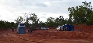
From here, we headed back down the road to find a campsite for the night. We looked for the eastern end of Frenchman’s Track and had a GPS reading showing it was on the Chilli Beach Road. We decide to find it as we were probably going to need it in a couple of days. It was a well-hidden goat track leading off into the scrub. Once again, a disused quarry was our haven for the night.
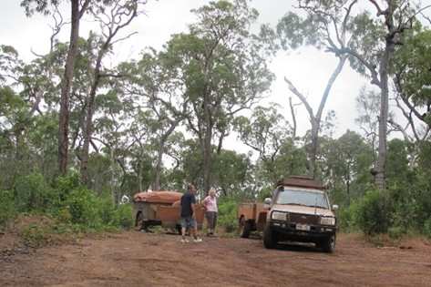
An overcast day greeted us as we broke camp on day 8. We were heading to Moreton Telegraph Station where we planned spend a few days exploring the area and have a look at Frenchman’s Track. Fuel is not available at Moreton so Steve & Maria, and Barbara & I were planning to back track to the Archer River Roadhouse to fuel up. Trevor the Younger and Julie planned to head straight to Moreton.
One of the things I have learned over the years is to fill the fuel tanks whenever the opportunity arises. I’ve been caught, previously, pushing the limits, only to be caught at the next fuel stop where they had run out of fuel or the power was out and they could not pump the fuel out of their tanks.
While we were at Archer River the four of us decided on an early lunch and check out the famous Archer River Roadhouse Burger. It lived up to its reputation! Fuel was $2.00 a litre, the most expensive for the trip.
The group came together later, at the Moreton Telegraph Station. This was once a repeater station for the telegraph line, which opened in 1887, that ran up Cape York and then to Thursday Island. The overhead wires were eventually replaced with a buried co-axial cable which was in-turn replaced with a microwave system in 1986.
There was a bit of confusion about site allocations with the staff realising that Steve and Maria’s site was already booked, so after setting up they had to un-setup and shift sideways 5 metres! Still the Moreton campground is excellent. We were camping here for a few days so we set up the camps accordingly.
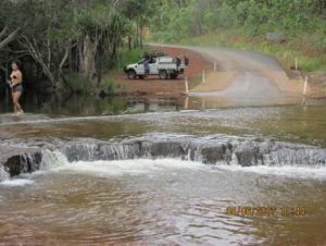
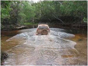
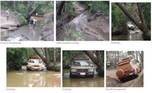
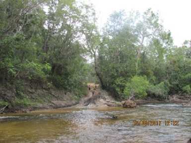
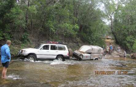
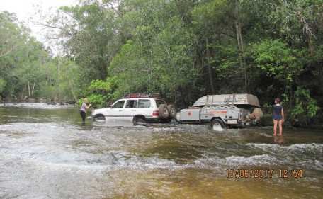
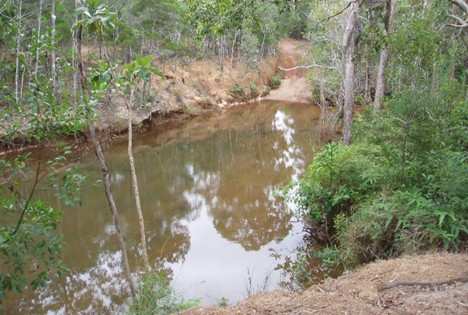
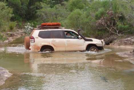
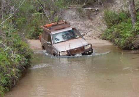
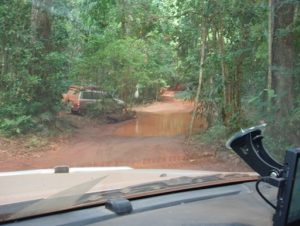
Day 11 saw us up and about early because we were going to tackle the infamous Frenchman’s Track. This track starts 22 km south of the Moreton Telegraph Station so we had to back-track a bit. It runs from the PDR back to the Chilli Beach Rd and it is 52 km long, winding through the characteristic dry savannah, bushy environment that characterises this country. However, there are two major rivers, many smaller tributaries, and a couple of swampy areas that have to be negotiated. The first major obstacle is the Wenlock River.
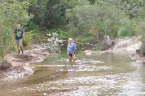
After investigating the crossing; the river was about tyre deep, not flowing very strongly and the base was very coarse river sand. We then worked out the best entry and exit points. There are two access tracks to the river – one impossible and the other reasonable. We all decided to take the reasonable one.
The crossing was made without drama so we continued on, crossing many small creeks and gutters, until we came to the swamp. The water/mud had the consistency of thin custard. We checked the track using long sticks and found very deep wheel ruts where vehicles, with much larger wheels than us, had gone through. I had experience of this on the Balfour Track in Tasmania, which resulted in a vehicle being written off because water/mud got into places where water and mud don’t belong. We decided that discretion was the better part of valour and turned around to back-track.
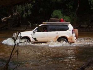

Arriving back at the Wenlock we found that the sandy approach to the crossing had be severely cut up by a large group of motor cycles doing wheelies in the sand. We all made it through but it was a bit of touch and go. From the crossing it was back to camp for a ‘lemonade’ and a discussion about the next day.
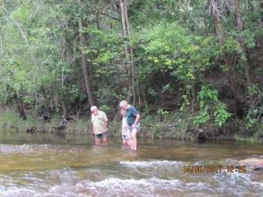
The following day, we drove back the 137km to the eastern end of Frenchman’s to have a look at the Pascoe River Crossing and do the track up to the swamp. The track to the Pascoe traverses a high plain with many washouts, ruts, steep climbs and descents. Barbara was driving and got to use the diff lockers (whose problems have finally been fixed – it only took 5 years!)
We eventually arrived at the Pascoe to find that the eastern side was a narrow gully, very steep and extremely rutted with a huge bog hole at the water’s edge.
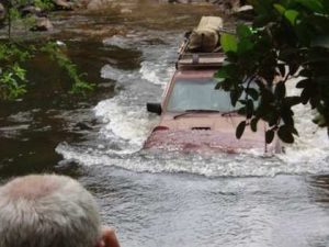
While we were contemplating the problem, a group of five vehicles arrived on the other side of the river. After a shouted conversation, they told us their side the track consisted of very large boulders
that were difficult to negotiate and they could not turn around. They had to cross! One bloke walked across. It was waist deep and flowing very fast. After a lot of hesitation one vehicle decided to ‘go for it’.
With a lot of spinning of wheels, he made it through the bog hole and then up through the rutted section with a lot of extreme bouncing. When he and his passenger got out a huge amount of water flowed out of the doors. The next vehicle across was a Nissan tray top, carrying a young family. They made it with the same driving technique as the first vehicle. LOTS of power, spinning wheels, and wrenching of the steering wheel to maintain traction, all of which caused much considerable bouncing.
We could hear a lot of shouting and other human type noises coming from the Nissan. The driver was in a high state of excitement because he had made it, the wife was crying and screaming in fear, while the kids were all shouting at the same time, “Can we do it again, Dad”! Once again, a considerable amount of water drained out of the doors.
At that stage, our group decided that we still had a long way to go and vehicle damage was a distinct possibility, so we turned around and headed back to camp the way we had come. The next day we planned to move a whole 63 kilometres to Bramwell Station and the start of the Old Tele Track.
As we only had 70 odd km to do on Day 12, we had a leisurely break camp and left much later than normal.
There are two Bramwells – the Junction and the Station – both owned by the same company. Bramwell Junction is right at the start of the Old Tele Track and consists of a fuel pump, small road-
house and a rudimentary camp ground while Bramwell Station is a much more salubrious camping area with good bush showers, toilets, laundry etc but no fuel. Which one were we going to select do
you think?
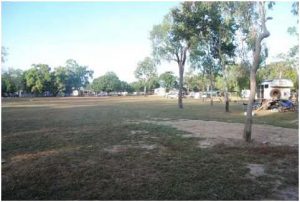
We drove to the Junction to fuel up, had a pie for lunch and then backtracked 15km to Bramwell Station, to set up camp for a couple of nights. When booking in, we were told that dinner was available in the Station alfresco area that night for $35 per person. That would mean no cooking or dishes. Hmmm, very difficult decision!
Bramwell Station is an active cattle business and is the northern most active cattle property in Australia. While waiting for dinner the ladies did some washing – there always seems to be washing to be done – while the three blokes just wandered about exploring the property.
The evening meal was excellent – steak, sausages, rissoles, vegetables, salads, home-made bread and dessert. Basically all you could eat. After dinner there was an entertainer who was a lot better than most bush entertainers! All in all, with a couple of ‘lemonades’: a really good night.
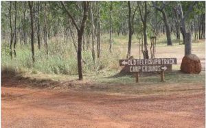
Early rise in the morning – we were going to explore the southern section of the Old Tele Track.
Day 13 dawned bright and clear and we were off to the OTT. The start of the track is next to Bramwell Junction so we had about 15 km to travel before the adventure began.
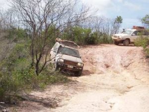
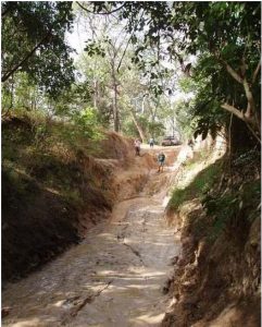
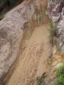
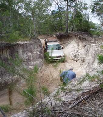
The first creek crossing is the notorious Palm Creek. This crossing is only talked about in hushed tones around campfires, on dark nights, with a mug of Stones Green Ginger wine in hand. It lived up to its reputation!
The entry was a vertical drop of a metre or so, into a bog hole which was 10 metres long. Then a simple crossing of ankle deep water, to a choice of two exits. If anything, the exits were worse than the entry. It was a case of impossible or impossible. The only way was to winch – not even a snatch would work.
While we were discussing the situation a Tag-Along Tour turned up with 8 vehicles. The operator took one look at the mess and decided it was all too hard and he would use the un-marked bush track about 25 km up the By-pass Road which lead back to the OTT. If it was good enough for him it was good enough for us!
After finding, and then transiting the bush track back to the OTT, we decided that we would head back south and have a look at the northern side of Palm Creek Crossing just to confirm that we had made the right decision. This would involve crossing Dulcie Creek. Checking the creek, it was found to be reasonably deep with an entry that required some critical wheel placements. The exit was good after about a 30m crossing and negotiating a dog leg in the creek.
Two couples decided to tackle it.The other couple would stay behind to mind the horses. After the good planning, both vehicles got through easily and then continued travelling south to have a look at to the north side of Palm Creek.
We arrived at Palm Creek just in time to see the last of a convoy of 5 vehicles being winched up the exit from the creek. They were all standing around having a celebratory beer or 5.
After a discussion with the group, we found out that they were five young couples from Brisbane on a trip to the Cape. It had taken them 3 hours of winching to get all 5 vehicles across. One vehicle was well set up with a winch and diff lockers and a lift. The other 4 were basically stock standard. After investigating the north side of Palm Creek and congratulating ourselves on making the right decision in not attempting the crossing, we turned around and headed back to Dulcie Creek to pick up our horse minders and then continue on up the OTT. Upon reaching the Dulcie, the group of 5 vehicles caught up with us. Our two vehicles negotiated the crossing and exit with ease, relying on good spotting and wheel placement. No dramas at all; no wheel spin, just good wheel placement and throttle control. Then all hell broke loose.
The other group just drove straight into the creek without checking and far too fast. The first vehicle made it up the bank with lots of revving, wheel spin and rock/mud being thrown. Oh dear.
The second and third vehicles came up the same way bringing a lot of water up the track and spinning their wheels, making the ruts deeper. Then it was the fourth vehicle’s turn. He had a bit of drama and had to make three attempts before he made it. On the last attempt there was terrible CRACK from the front which sounded like a CV joint letting go. In the meantime the fourth vehicle is sitting in the deepest part of the creek, complaining that water was up to his ankles. He eventually exited the creek. I could not keep my mouth closed and pointed out that my wife had driven the exit without dramas because we had taken our time to plan the exit and spot for the drivers. I also pointed out that they had stuffed up the track and made it difficult for anybody else. Their answers were un-printable!
That conversation is now in my auto-biography in the Chapter ‘Conversations I Wish I Had Not Started’. Seems that the only training they had done was to watch ‘Roothy’ and YouTube. We left them to their own devices and with the three vehicles now back together, continued north. Travelling on we crossed “South Alice Creek”, North Alice Creek”, “Dulhunty River” and “Bertie Creek” with its dog leg . All were done with relative ease.
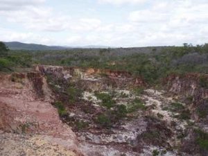
Then we came to Gun Shot!
This is another of those crossings that are spoken of in fear around a campfire on dark nights, with the wind howling in the trees and a bottle of Stones Green Ginger wine being consumed. The plan was to have a look and see if it was ‘do-able’ then turn around, travel back to the southern Gun Shot bypass track, about 12 km and travel out to the By-Pass Road and head back to Bramwell Station for the night. We would come back the next day via the By-Pass Road and the Gun Shot bypass track and do the crossing if it was feasible.
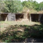
Gun Shot had at least 6 entrances visible, all of which had near vertical drops of at least 2m and then a bog hole at the bottom which had to be crossed before you got to the creek. The exit seemed to be OK.
Various Gunshot Entries
After deciding that none of these entries were do-able, we were just about to turn back when Julie found another entry. It was hidden by bush a little distance from the crossings we were looking at. We had been told about this one but had been unable to find it, the bush was that dense. This one was definitely the best choice. There was a bit of a drop and a few ruts but nothing we could not handle and, more importantly, not much chance of vehicle damage.
A quick discussion and the decision was taken to complete the Gun Shot crossing and then head back to camp.
Returned to Bramwell Station camp via the northern Gun Shot by pass and the By-pass Road. We felt very pleased with ourselves that night as we relived the day’s adventures over a celebratory ‘lemonade’ or two.
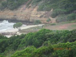
The next day, Day 14, we were travelling back up the By-pass Road to visit Captain Billy Landing. We had originally planned to camp there but once again the problems with the National Parks booking system defeated us.
So we decided on a day trip from Bramwell Station.
The trip up the By-pass Road was uneventful and the road into the landing wound through thick rainforest which was quite narrow at times, with hanging vines scraping the cars.
Captain Billy was the name of a prominent Aborigine in the area in the late 1800’s.
Captain Billy Landing was built in 1968 by the mining company Comalco to service its experimental cattle property. The experiment collapsed and the lease for the property was handed back to the Government in the early 70’s. We were fortunate that we could not camp here – the wind was horrendous. Pity – it is well set up with water and toilets. The 110 km drive back to Bramwell Station was uneventful other than getting a little geographically embarrassed when we took what we thought would be a shortcut via some back roads to get to the Station.
The morning of Day 15 (June 15th) was a 130 km transit back up the By-pass Road to a free camp we had been told about near Sailors Creek, just near where the By-pass Road crosses the OTT. It turned out to be another disused quarry and was not much of a campsite, but it was free and out of the wind. (It was that windy we decided not to have a campfire.)
We dropped the trailers and set off to explore the section of the OTT between Gun Shot and Sailors Creek.
We were now going to have a look at the section between Sailor Creek and Gun Shot.
We had driven up from Bramwell Junction and made camp in a free camp; an old quarry near Sailor Creek.
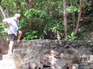
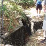
Sailor Creek has a rough log bridge made out of tree trunks. As one of the bottom logs collapsed, a kind-hearted traveller would add another at the top. This worked well until the last wet season when, unfortunately, the north bank was washed away, leaving a gap about two metres wide and a metre deep between the end of the ‘bridge’ and the bank.
Fortunately there was a somewhat hairy bypass: a steep drop off, a 30 metre run in the creek bed and then a wet, sloppy, muddy exit. After a couple of ‘interesting’ moments we all got through and continued on. There were several minor creek crossings and we had to skirt Sheldon Lagoon.
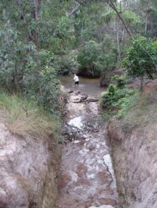
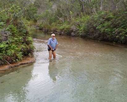
This brought us to Cockatoo Creek. Cockatoo Creek is a deep crossing with a rocky bottom and a few ledges. It requires good planning and spotting.
Two couples decided to do the crossing while the others would stay back to mind the horses.
The entry was pretty simple, just a rutted mud slope. The best way across was determined to be the deepest spot. After check the crossing it was time to ‘give it a go.’
After the good planning and spotting, Barbara made it without any problems.
While Barbara was in the process of doing the crossing that awful cry, “SNAKE!” came from the top of the exit track. Seems that the beastie was seen sticking its head out from behind a rock just on the side of the track. Hmm. No avoiding that spot either. Then it was Maria’s turn.
At the top of the exit, and avoiding the rock with snake, we found a really great camping area with toilets. Moving away from the top of the track and the resident beastie, this was to be the lunch stop. A very pleasant hour or so was spent contemplating the surrounds and enjoying the lunch break.
After checking out the map, there were no real crossings left in the 5km to Gunshot. Just a transit along a bush track; so we decided to turn around, cross the creek and head back to camp for an early end to the days activities.
While we were discussing the rest of the days activities, a 200 Series turned up towing a camper.
We collected the ‘minders of the horses’ and headed back to camp; negotiated Sailors Creek without any problems, and settled in for a chat and a ‘lemonade’.
On Day 16, after a windy night and a bit of rain, we had an early, damp pack-up and were on the road by 8:00.
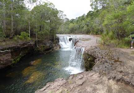
Today we were going to investigate Fruit Bat Falls, Eliot/Twin/Indian Head (take your pick) Falls and then amble along the OTT having a look at Sam Creek, Mistake Creek, Cannibal Creek and Cypress Creek.
Fruit Bat Falls and Twin Falls are iconic places on the OTT and, being quite near to the Main Bypass Road, all of the “adventure bus tours” with their 20 seat, 4 and 6 wheel drive vehicles, drive in to show the “glampers” the “real” north Queensland tropics (do I sound contemptuous?) The consequence of all of this heavy traffic is the road and the minor creek crossings are in extremely poor condition.
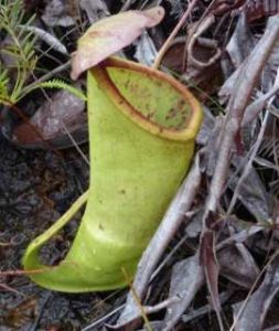
Anyway, we negotiated the chewed up track, with our trailers in tow, and arrived at Fruit Bat Falls. There is a colony of Pitcher Plants around Fruit Bat Falls. These strange plants ‘eat’ flies, mozzies, other insects and very small animals that get trapped in the sticky digestive juices in the bottom of the pitcher. When an animal of some description falls in, the top of the plant closes to make sure that it is well and truly trapped. It is then digested by the plants juices and absorbed. It’s basically eaten alive.
Thank God these things aren’t 10 feet tall! This one is about 400mm high. From Fruit Bat Falls we moved on to Eliot/Twin/Indian Head Falls.
Arriving at Canal Creek we decided to park the trailers while we continued on. We could see no point in dragging them through the creek crossings for no reason. We would be back later to collect them.
Before we got to the turn off to Eliot/Twin/Indian Head Falls we had to cross Canal Creek and a couple of other minor crossings which caused no difficulties.
The Eliot and Twin Falls are actually separate falls on different water ways. The Twin Falls creek runs into the Eliot River. I never did find Indian Head Falls.
After looking at Eliot Falls, we headed up the track to tackle a couple more creek crossings.
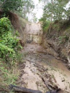
Sam Creek required a bit of planning. It had a vertical drop off a rock shelf of about two feet. There were also a myriad of tracks leading away from the creek. We went around a couple before we found the way out.
After crossing Mistake Creek we arrived at Cannibal Creek. The entry was ‘doable;’ the crossing was’ top of the wheel’ deep with a dog leg to the right. Then came the Exit. The Exit was a steep, chewed up, rutted, muddy mess.
There were many logs and rocks already in the ruts and it would take a LOT of road maintenance to make it passable. It look liked the group of 5 vehicle that we had come across at Palm Creek had been across and deliberately stuffed it for everybody else. It was really bad.
As it was getting late and we had to back track across Mistake Creek to get to the track that would take us out to the Main Bypass Road, drive around to where we had left the trailers and then find a camp for the night, we decided to give it a miss.
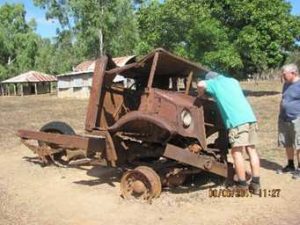
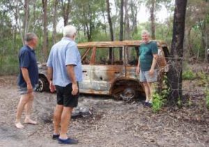
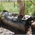
Could not find any details about this car. It is just off the track near Cannibal Creek. It would sure mess up your day if it happened to you.
After back tracking the 40 odd km to pick up the trailers and then head back along the Main Bypass Road, we found another disused quarry that would be ‘home’ for the night.
The sun came up, as per usual, on Day 17. We had planned to stay at Vrilya Point for a couple of days but we had heard it was closed. There were several conflicting stories –
The truth was somewhere in that lot. We decided to leave the trailers and head north then use the exit from the OTT to go in and have a look at Nolan’s Brook from the northern side. On the way we passed the turn of to Virlya Point; it had a locked gate across it. I guess they were dinkum. We duly arrived at Nolan’s.
There was a young family camped in an idyllic camp site right on the edge of the water. They were from Weipa and had taken a few days off to do a bit of exploring. They were driving a brand new Toyota dual cab with a lift and bigger tyres and a few other goodies. On the back was a custom made canopy. It was a good looking unit. After talking to the bloke he said that they had had considerable trouble negotiating the crossing. It was deep and sandy with a strong current.
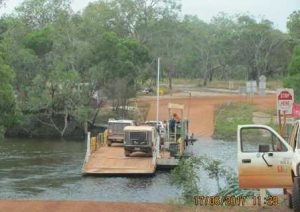
Vehicle drowning was a distinct possibility so we gave it a miss. Back to our camp in the quarry to pick up the trailers. Connected up and found that the trailer brake lights weren’t working. After dismantling both the plug and socket I found that there was a broken wire and the moulding that held the pins in place was broken. After a temporary fix we were off to the Jardine Ferry and our camp site at Seisia.
Because we could not camp at Vrilya Point we were two days early getting to the Seisia camp ground. Bookings at this time of year start to get heavy so we were worried about getting the extra two days at the camp ground.
The managers could not have been more accommodating but they had to put us in the overflow area across the road.
There was plenty of shade (it was hot and humid – not my ideal environment) and we were close to the toilets and showers, so it was more than adequate. We were staying here for six nights so we set up camp accordingly.
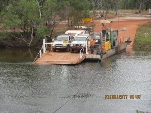
The Jardine River ferry had cost $129 for the 3 minute trip! The fee covers all bush camping north of the Jardine (we had already paid to stay in the Seisia caravan park) and fishing (none of us had fishing gear) BUT it was for the return trip. Hmmm. The locals pay substantially less to use the ferry.
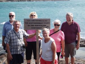
It was hot and humid at 8:00am on Day 18 as we left camp to tick off one of the cardinal points of Australia (the northern most). We left early because we had heard that the parking at the Tip itself becomes very crowded.
We decided to use a backtrack to get to the main road to the Tip. After a couple of kms there was a sign – Trespassers will be shot! We beat a hasty retreat. (We spoke to a local about this and we were told that it is a gazetted road. The owner of the property that it passes through is a recluse and has a few issues with people and put the sign up. The council takes it down and he puts it back!)
We actually found it was difficult to find the road to the Tip. After it became obvious by the GPS that we had passed the corner, we back tracked and found a road sign that pointed to Pajinka and underneath in much smaller letters – The Tip. The formal name has been changed to Pajinka. The road winds through the rain forest with a few mud holes and a couple of creek crossings.
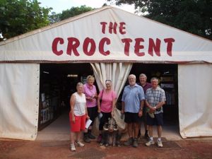
On the way you pass the infamous Croc Tent. This is just a souvenir shop that sells the normal Chinese “tatt and crap” that all these places sell. Of course we had to stop and have a look. As is normal in these places, the blokes were bored stupid and some of the ladies had a great time. After the girls had stocked up with presents for grandkids and nieces and nephews and we collected a very good and free map of the area, with lots of notes and interesting places to visit, we continued on.
The road passes what looks like a high-end, luxury but abandoned resort I later found this on the www –
“The Cape York Wilderness Lodge was opened in 1986 by Bush Pilot Airways (later Air Queensland) which reportedly owned 3600 acres of land including The Tip itself. The resort cost $1.2 million and was known for its fishing charters and a popular Indigenous experience it offered to guests. Ownership changed to another airline, the now defunct Ansett Australia, and later to Qantas Airlines, who owned it at the time it was sold to the Injinoo Aboriginal Cooperation in 1992. The resort, by then renamed the Pajinka Wilderness Lodge, closed in 2002 for renovations and was due to reopen in 2003, but it never did. “Poor management” was one of the key reasons given as to why the lodge closed and there are reports of clashes between Indigenous staff from different clans and a staff walk-out over unpaid wages.” I guess that also explains the name of the road.
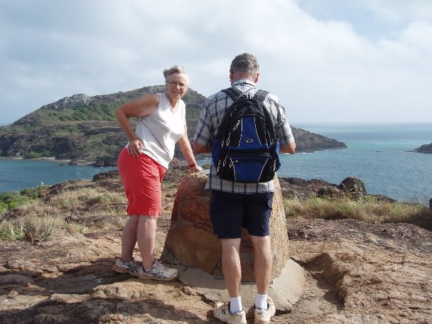
The car park for the Tip is at Frangipani Beach and holds about 10 cars. It would be chaotic in the High Season. Anyway, we all found a park and after loading our backpacks with water, sunscreen, cameras and a couple of energy bars we set of for the 20 minute walk across the ridge to our ultimate reason for the trip – a photo at the northern most point of mainland Australia. At the top of the ridge is the mandatory plaque showing the directions and distances to various places. Adelaide even got a mention.
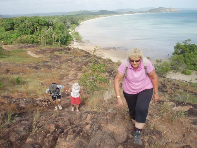
After spending a bit of time absorbing the ambience of the Tip and Trevor the Elder slipping base over apex into a puddle and getting a wet bum we trekked back to the vehicles. Arriving back at the car park we were glad that we had left camp early. The car park was full and cars were parked a good 500 meters back down the road. As this was early in the season God knows what it must be like during the peak. We moved on to explore more of the area.
Drove over to the Somerset ruins which was one of the very early attempts to settle Cape York and was the original seat of Government for Cape York. The local indigenous people had taken exception to the ‘white invaders’ and so the Government set up a police base, military post and a magistrates court to ‘pacify’ the area.
At Somerset Beach there are a few very old graves including a couple of Chinese headstones.
Across the channel from Somerset is Albany Island where the members of the Kennedy Expedition are buried.
On the way back to camp we all stopped on the side of the road in Bamaga where we had been told there was Wifi coverage to retrieve emails.
We had seen an advert for a fish and chips dinner at the Loyalty Beach camp so we decided that we would give it a try. $15 a head for a huge serve – couple of bits of fish and lots of well-cooked chips and best of all – no dishes.
After a reasonable night’s sleep broken only by the local donkeys ‘talking’ to each other Day 19 dawned in the now familiar conditions of sunny and humid.
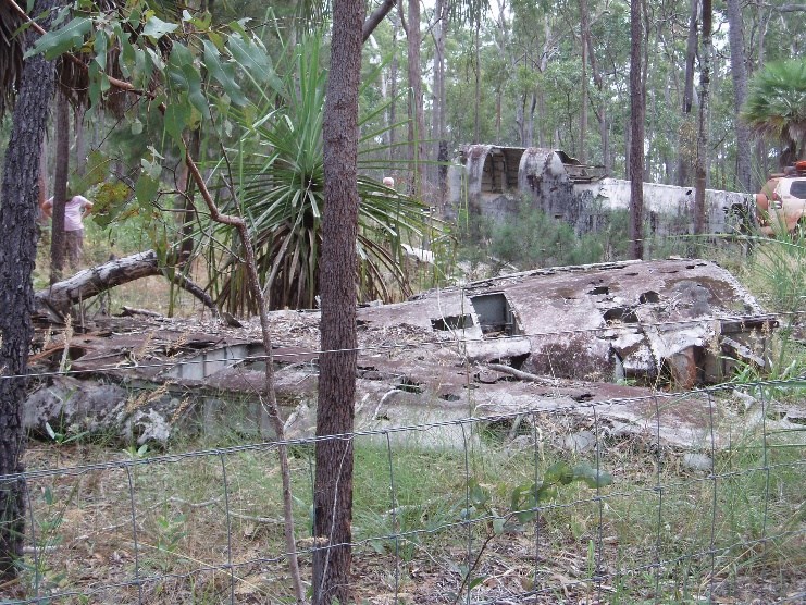
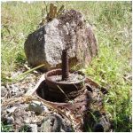
Today we were going to have a look at the WW2 aircraft wrecks and the Muttee Head radar station ruins. There was a huge military presence across the top of Australia from Broome right around to Cairns. There were nearly ½ a million men and approx. 200 operational air fields in that vast area during the war. There were many aircraft crashes and some shot down or destroyed on the ground during the hostilities. A few of these have been identified and are now preserved as memorials to the awful conflict.
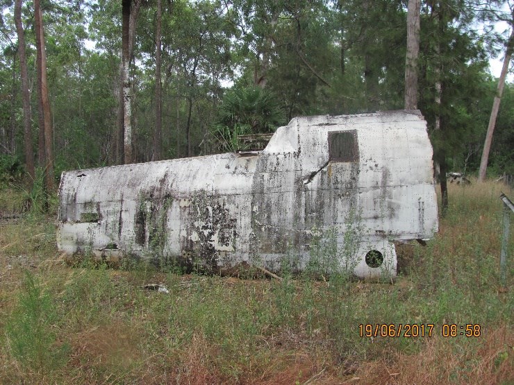
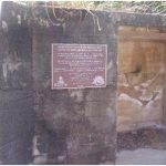
The next series of photos are of a DC3 (Dakota) which crashed 5th May 1945. The six people on board were all killed. Unusual for this period the pilot was a civilian.
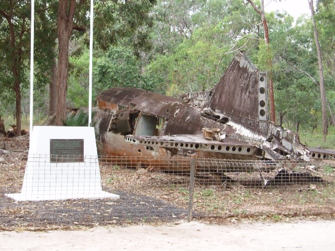
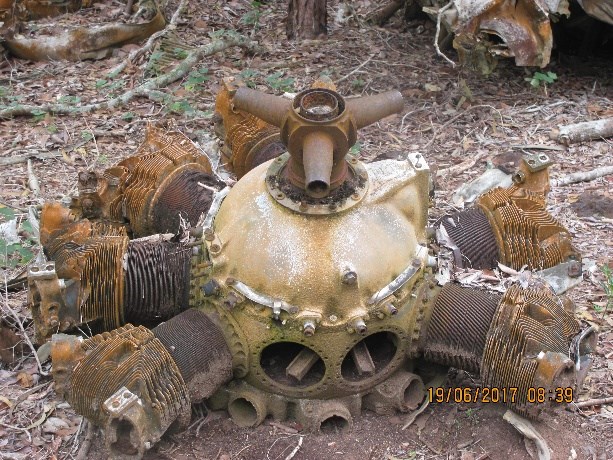
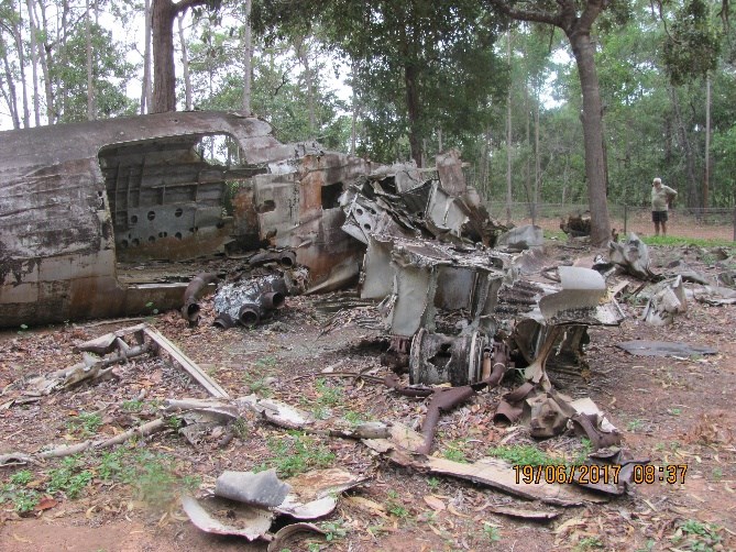
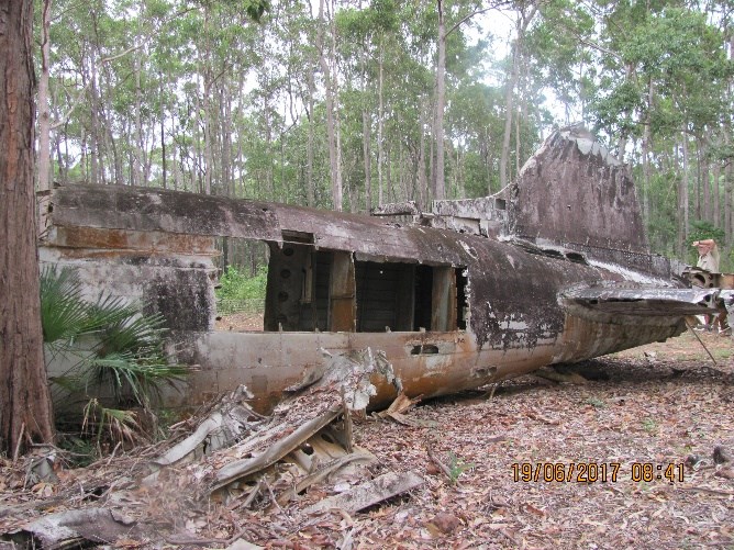
The next photos are of a Bristol Beaufort Bomber. The crew of three were also killed. All up, there are hundreds of wrecked aircraft across the top of the country.
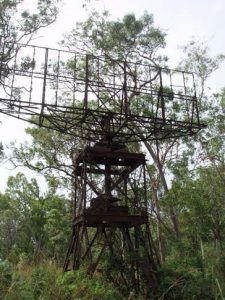
The final place to visit was the WW2 radar site at Muttee Head. This is one of the very few radar sites of that vintage that still has the antenna mounted. Muttee Head was also the site of the main supply wharf and warehouse for all of the American troops stationed in the area. Nothing remains of what must have been a huge undertaking. After visiting these historical sites it was back to camp for some running repairs and some cheese and ‘lemonade’.
On the way back to camp I had to drop into the local auto parts supplier, which just happened to be the local wrecker, towing organisation and mechanic. In the yard were eight almost new Toyota Hi-Luxs. They had all been drowned with water entering the cab and shorting out the engine management computer. The EMC in these models has been shifted to the passenger foot well and any water entering the cab shorts out the system. All of the vehicles had been written off. One had 27000 km on the clock.
That afternoon we had to pack overnight bags for our trip across to Thursday and Horn Islands.
We had to be up early on Day 20 – we had to catch the 7:30 ferry for the hour and a bit crossing.
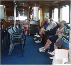
The trip across was on smooth seas and even our travellers who were prone to seasickness did not have a problem.
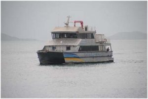
We had all packed overnight bags, cameras and too much other stuff as usual. TI does not have an airport. All passengers fly into the airport on Horn Island and then transfer across by ferry. The ferry trip to Thursday Island takes about an hour and 10 minutes and is a 30km journey. The crossing was quite calm and we arrived at the Thursday Island ferry terminal at about 10:30 to be met by our tour bus for a guided tour around the island.
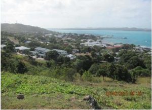
Thursday Island became the administration centre for the Torres Straight area in 1877 after it was found that Somerset on the Cape was unsuitable because it lacked a good harbour. TI is now the administration and commercial hub. The main hospital for the area is also on the island. The hospital has a fleet of helicopters to transport emergency cases. Other patients have to travel by boat or ferry.
As WW2 progressed it became the military headquarters for Torres Straight and was the base for Australian and American forces. At its peak, there were 2000 service men and women stationed on TI. During the war TI was not attacked by enemy forces, unlike nearby Horn Island.
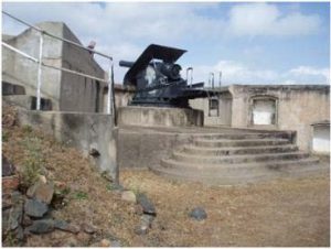
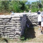
Green Hill Fort at Battery Point on Millman Hill, the highest point of the Island, was developed into major gun emplacement for the war. The fort is now an historical monument and museum. It was originally built during the ‘Russian Crisis’ of the late 1800’s.
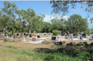
The tour took us to the local cemetery; an unlikely tourist destination but interesting never-the-less. The Torres Straight Islanders create lavish and expensive tombstones for their loved ones. It can take many years for them to get the money together and then have the tombstone made and erected. Once the tombstone is finished they have an official unveiling which is a time of joy, celebration and closure.
There is a large number of Japanese pearl diver burials in the cemetery as well. One of the reasons put forward for the fact that TI was not attacked by the Japanese during the war was the presence of these burial sites.
Once the tour was over we were left to our own devices for the rest of the day. We spent the time wandering around having a look at the various historical sites. A well-known local singer and recording artist, Henry Gibson, “Seaman Dan”, was sighted in the main street. “Seaman Dan” has received many awards for his singing and was the subject of an article on Land Line a few years ago.
By now it was lunch time and we had heard about a local delicacy – Crayfish Pies. Given my propensity for sea food I just had to try one. We spent a long time looking for the bakery and when we did eventually find it we were told they only make 12 a day and there is always a queue waiting to buy them. We were several hours too late! At $12 each they would have to be good! So, after a long walk and incredible anticipation, I had to settle for a flamin’ plain, meat pie. Bugger! (Actually, the pie was pretty good but still a disappointment).
After lunch we were able to access our accommodation for the night. We had paid $250 for the accommodation package at the Grand Hotel so we were expecting something special. To say we were disappointed is an understatement. The hotel itself has just been refurbished but they seemed to have stopped at our rooms – 2 star rooms and ½ star beds!
The afternoon was spent wandering around the town. For a change we actually fell on our feet for dinner in the pub. It was $10 special night.
Barbara and I spent a difficult night in a double bed (we have a queen size in the camper and a king size at home). The mattress had collapsed in the middle and we kept rolling inwards and waking each other up. I know what you going to say but after 40 years of marriage a good night’s sleep is preferable. After breakfast we headed to the local ferry terminal for the trip across to Horn Island to start the tour of that island.
Torres Straight time seems to be a little different to the rest of the country’s. The ferry was a just bit late in starting the 20 minute crossing. We arrived on the Island and were picked up by the tour company and were driven about 500m to the only resort on the island.
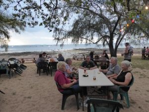
As it was now lunch time this was to be our lunch stop. We had had the choice of a restaurant meal, a café meal or a ‘bring your own’. Being miserable old bastards we had all decided that a ‘bring your own’ was the way to go. We ‘borrowed’ a couple of tables and set ourselves up in the garden and enjoyed our rolls and cheese and pickles and ham and beef and tuna and salad. We did buy a drink from the bar, ‘lemonade’ of course, to keep the island economy going.
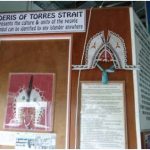
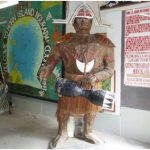
Attached to the resort is a private museum owned by Vanessa and Liberty Seekee. On display is an incredible range of artefacts showing Torres Straight and Horn Island’s rich history with a considerable emphasis on the part played by the island in WW2. We all spent an hour or so wandering through the exhibits.
Vanessa has written the definitive book about Horn Island’s role in WW2. It is well worth a read. If you can find a copy it’s called –“Horn Island. In Their Steps 1939 – 45”.
During the war there were 5000 troops, Australian and American and a hand full of nurses, stationed on Horn Island. All aircraft flying out of the northern airstrips around the coast of the Gulf and Cape and as far down as Townsville were staged through Horn Island on their way to and from raids on the enemy. A large hospital was set up to treat the wounded returning from the raids.
The island suffered from 8 major bombing attacks and several small raids. In all about 150 allied servicemen were killed in these attacks. As a consequence there are a huge amount of war relics scattered about the island. There are bits of aircraft, fuel dumps with thousands of rusting 44 gallon drums, light and heavy anti-aircraft gun emplacements, slit trenches, buildings and camp bases. There is an ongoing archaeological activity to determine what’s what and to improve the knowledge of the war time activities on the island.
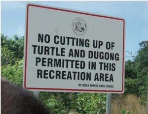 The Torres Straight Islanders culture is still extremely strong and they have special dispensation to maintain it. This includes being allowed to hunt their traditional food sources. They are allowed to take turtles and dugong for special celebrations and ceremonies.
After the intriguing tour we were transported back to the wharf to catch the ferry back to Thursday Island and then, in turn, the ferry back to Seisia. We arrived back at camp in the late afternoon just in time for an afternoon ‘lemonade’.
The overnight tour to the islands was a little drawn out and, in hindsight, it would have been better to do the single day tour.
On Day 22 the sun came up to provide the normal hot and humid conditions that we had come to expect. It was our last day at the tip before we started south. We decided to investigate the resort at Punsand Bay.
Taking our lives in our hands, we travelled via the back road with the sign Trespassers will be Shot! I mentioned that in Part 4. Needless to say we did not have to go to hospital with gunshot wounds.
Punsand Bay Report is a 5 star establishment with all of the amenities that you would expect. The cost is also what you would expect. After a leisurely morning tea of coffee/tea, scones and jam and cream we headed back to Seisia to check over the vehicles, pack and prepare for the trip south starting the next day.
This was day 23 and we were starting the long trip south to home. The three vehicles had been fuelled up the night before so all we had to do was complete the packing, connect the vehicles to the trailers and we were off. Well, that was the plan anyway.
Steve boarded his vehicle, turned the key, there was just a click! The purring of the Prado’s diesel engine was noticeable by its absence! Oh dear! So, out with the tools and the multi meters and after a few false trails and several attempts to start the motor, we diagnosed the problem as a crook starter motor.
As we had done a few deep water crossings, this was not totally unexpected. With a bit of a bush mechanic’s attitude and while Steve turn the ignition key, I hit the bloody starter motor with a hammer (a big hammer and a silly grin can fix a lot of things as my dad used to say) and the engine burst into life. We all breathed a sigh of relief.
Steve and Maria made the decision to drive straight to Weipa without turning the engine off while we, and the Goldsmiths, would spend a night at the Moreton Telegraph Station where Julie had to pick up a couple of bottles of spirits. The indigenous area of the Tip does not allow spirits to be brought across the Jardine so Moreton will store any forbidden alcohol for you to collect on the way south.
We were a little in front of the crowds leaving the Tip that day so we did not have to wait long for the ferry. You only have to pay for the Jardine ferry when you are going north so the cost of re-crossing the river is covered.
The drive south to Moreton Telegraph Station along the Main Bypass Road was uneventful other than getting heartily sick of the bloody corrugations. The plan was to stop for lunch at Branwell Junction, however, as it was Friday, Steve and Maria were going to push on straight to Weipa to see if they could organise a mechanic to have a look at their starter motor problem.
The Burfords and Goldsmiths stopped for lunch and had a pie or two and added to our cholesterol count with an ice-cream. After lunch we then drove the 70km to Moreton for an early set-up and shower.
We always plan to be off the road by 3:30 the latest and this plan held us in good stead for the whole trip. We arrived at Moreton around 2:30 and there was only one other vehicle in the park, so we had the choice of camp sites. By 4:30 the place was full to overflowing and a long queue for the showers.
Julie promised a camp fire baked cake if we could find enough wood for a fire. That was an offer that could not be refused so we all went wood scavenging. Moreton is a very poplar place and wood was very difficult to come by but we persevered and managed to scrounge enough for a decent cooking fire. The cake was fantastic and didn’t last long!
Day 24, Saturday the 24th of June, was a quick transit to Weipa via the Batavia Downs road. By now there was a large amount of traffic on the road – all heading north and mostly towing camper trailers.
As planned, Maria and Steve had arrived the previous day and organised camp ground sites for us. We were lucky that he did because once again the park filled up very quickly. Unfortunately, our sites were in full sun for most of the day. It was that hot in the direct sun that the safety valve on one of our gas cylinders started popping off. I had to drape a wet towel over it to cool it down.
Steve had made contact with the local mechanic who was booked out and could not do anything for him until the Monday morning. Fortunately, he had a spare Prado starter motor in stock. Given that we now had to spend an extra day in Weipa we decided to do a guided tour of the town and mine (and were forced to sample the delights of the bakery – I can recommend the vanilla slices).
In 1898 the Presbyterian Church set up an Aboriginal Mission in the area. In 1955 it was discovered that the red cliffs commented on by early Dutch explorers and Mathew Flinders were actually enormous deposits of bauxite. Comalco (now Rio Tinto) started mining in 1960 and made the first export in 1962. They built the town of Weipa to house the workers and their families. That was way before the common Fly-in Fly-out arrangements that most mines now use.
For a town 3300 it has a huge range of facilities. It has a visitor’s centre, swimming pool, bowling green, golf club and tennis and squash courts. There are netball and basketball courts as well as football fields, both Aussie Rules and that funny Eastern States throwball game. The Weipa Town Authority operates a public library.
At Nanum (basically a suburb) the shopping precinct has a Woolworths supermarket, bakery, coffee shop, travel agent, clothing shop, post office, news agency / sports shop and butchers. There is also a chemist, camping and fishing store and within walking distance is a gift shop, furniture and whitegoods store, credit union and Centrelink office. At Evans Landing there is a hardware store and a number of mechanical workshops.
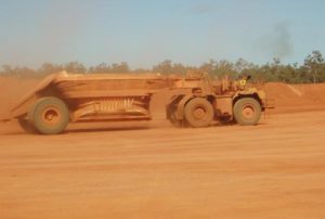
The mine is the world’s largest bauxite mine exporting over 30 million tonnes of ore annually. There is an average of 2 metres of top soil which is removed and stored. Then the 3 metre layer of ore is extracted by scraper and the top soil replaced and re-seeded with previously collected seeds.
The ore only has to be scraped up by a bulldozer (no blasting) and is then loaded into large tippers for the trip to the crusher and grading plant. From there it is transported to the dock by a variety of means depending on the area being worked. There is a large conveyor belt system, road haulage network and a railway network. An interesting tour.
Steve and Maria’s Prado had been booked in to the mechanic for 7:00 on Monday morning for the repairs. We had to quit our campsites by 10:00 so there was a bit of coming and going to tow the Prado to the workshop (it would not start even with a bigger hammer and an even sillier grin) and get all of the trailers out of the park before we were charged for an extra night.
Unfortunately, we had to spend a bit more time at the bakery while we were waiting for the vehicle to be fixed. The things one has to do!
A new starter was fitted and the vehicle was now starting properly. After a considerable amount of S & M’s money exchanged hands with the mechanic, we finally left Weipa at 11:45. We arrived at the Archer River camp ground a lot later than our normal 3:00 to find it basically full. We found some less than ideal campsites but, according to the ladies, it was worth it because the camp ground had showers and flush toilets.
Day 27 was a transit from the Archer River Roadhouse to Lakeland. The road was corrugated and rough. It had changed dramatically from when we travelled north three weeks previously. It had gone from very bad to bloody awful.
Because of some diseases prevalent in the tropical north there is a Quarantine Station at Coen where they confiscate most tropical fruit and veg from vehicles travelling south. There can also be fishing inspectors looking for illegal amounts of fish. We were actually given a compliment because South Australians never question the need to hand over the food stuffs because we are well aware of the need for Quarantine stations. It seems that the officers are given a hard time by a lot of the travellers when they tell them they have to hand over their fruit and veg.
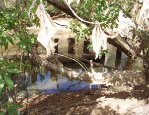
Our lunch stop was at Laura where we found a sign pointing to – Railway Bridge Ruins. After following a goat track for a couple of ks and a walk for several hundred metres, we found the remains of the bridge. To say it was underwhelming is an overstatement.
After the Palmer River goldfields were discovered in 1873, it became obvious that a faster method of transport was required to get to the goldfields from Cooktown. The then current method of travel was by horse and cart/stage coach which could only be done in the dry season and then it could take up to a month.
Construction of the Cooktown to Palmer River train line commenced in 1884 and arrived in Laura in 1888. Work then paused until a feasible route could be found to the goldfields. The selected route would have required 8 tunnels and several major bridges and cost in currency of the time, 1 000 000 pounds. Because of an economic downturn, the railway extension to the gold fields was never constructed and the line to Laura was finally closed in 1961.
Leaving Laura we started to look for a bush camp. However, both sides of the road were fenced and all of the side tracks had signs indicating that unwanted visitors were not welcome. Very un-friendly. Anyway, a camp site could not be found and we eventually reached the village of Lakeland. The caravan park had a No Vacancy sign out but as it was now nearing 5:00 we decided to chance our luck and ask anyway. The manager was very accommodating and as we did not require power she fitted us in but we had to vacate by 8:30 the next morning because she had vans booked in. It took us about 2 seconds to accept. It seems that there was a local rodeo that was taking up all of the available camp sites.
By now the amount of traffic travelling north had become extremely heavy. The morning of Day 28 was a little colder and drizzly. In fact we all had jeans on for the first time in a couple of weeks. Today was a short trip to the Palmer River Roadhouse. Bit of a drama after a couple of ks – we had smoke coming from under the bonnet! Turned out to be a dribble of oil from when I had added a bit the night before. Phew!
When we arrived at the PRRH the manager took a look at our rigs and “suggested” we give them a wash. He said that he had unlimited water and there was a hose and brush on the lawn. I must admit that our rigs were covered in mud and dirt. I thought they had character and wanted to leave ours but I was over-ridden. 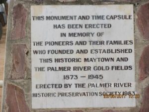 Actually, the amount of crap that came off the vehicles was incredible. I think that he just wanted his lawn top dressed. The rest of the day was just relaxing and doing some minor repairs. We did have time for a “lemonade” or two or three in the bar.
Day 29 was overcast as we left for a 200 km round trip to the Palmer River Goldfields and Maytown ruins. We had picked up a ‘mud map’ from the roadhouse for the trip and left around 8:30, planning to have lunch in the historic area.
The Palmer River Gold Rush started in 1873 when large deposits of alluvial gold were found in the Palmer River. Several towns sprang up to support the miners. There were the usual problems of disease, dishonesty, drunkenness and all manner of vices associate with these sorts of environments.
The extremely rich alluvial working gold to become worked out after a few years and the emphasis changed to reef/underground mining in the Maytown area. Maytown gradually became the centre for administration and business for the filed and had all of the infrastructure to handle the 13 000 miners in the fields. By 1945 there was very little left in Maytown.
Officially there was around 1 million ounces of gold taken from the combined Palmer River/Maytown fields but like all of these early mining areas it is estimated that only 1/3rd of the gold was passed through official channel. There are still several small mines working in the area and many examples of late 1800’s mine equipment scattered through-out.
After one of the stops to have a look at an old mine, I turned the ignition key and there was that awful, gut wrenching “click” and nothing else. Thoughts of Steve’s problems flowed into my brain. On the fourth attempt – success! The old girl‘s engine fired up and I started to breathe again. It would have been a long tow to the main road if the car had not started. We decided to forgo lunch and drive straight back to the semi-civilisation of Palmer River Road House.
Day 30 was to be a quick transit to Atherton. We had planned to end the trip in Cairns but decided to finish on the Atherton Tableland. Mareeba was our first choice but as the Rodeo was in town, along with the local show, the place was completely booked out. So Atherton it was. With great trepidation I turned the ignition key and the vehicle started first thing and we all said farewell to the Palmer River Road House.
We arrived in Atherton caravan park and set up just as it started to rain. The lawn area for the tent and campers was at the bottom of the park just to where all of the water drained. We found an auto electrician for Monday, as it was Friday afternoon. (Why do these things happen just before the weekend?). It rained a lot that night and next morning it was extremely soggy underfoot.
Because we were now in a ‘civilised’ area we took the chance to do a bit of sight seeing. If I couldn’t get the car started then there was always the RAA (or the local equivalent). One of the places visited was the Spy Camera Museum at Herberton. If you are ever in the vicinity it is well work a look.
This was the final night of our trip so we were booked into the local community club for dinner. It rained. The next day Steve and Maria were heading home to wait for the birth of their first
great grand child. The Goldsmiths were leaving Sunday to head for the Sunshine Coast to visit friends and we had to wait until Monday to have the car fixed.
It rained. It turned out we too had a wet starter motor. I had both the alternator and starter motor replaced just before the start of the trip and now it was recommended that we have a new one. Bugger!
We got the car back at 1:30 and after some dramas, got the trailer and car off of the extremely muddy camp site (dug some huge wheel tracks in their lawn) and headed for home via Mount Garnett, Charters Towers, Theresa Creek dam – where we spent a couple of days with Jenny and Barry Anderson, Sapphire, Tambo, Charleville (did the World War 2 tour of the airport – 5,000 American troops working in total secrecy on the Norton Bomb Site, and the Cosmos Centre), Roma (where we did the free tour of the cattle yard sales), Dalby, Warwick (coldest place we have ever been to) and then back to visit my brother and his family on the Sunshine Coast and finally – home via Tamworth, Cobar and Broken Hill. It was so cold on the way home we cheated and took cabins and even a motel room.
We arrived back in Adelaide on the 27th of July, having left on the 16th of May.
A truly great trip. Thanks to the Julie & Trevor and Maria and Steve for their company, companion-ship and their good humour. Thanks to Julie, Trevor (the younger) and Maria for their photos.
And finally, if you plan to do a Cape York trip then do it soon. The road to Cape is planned to be fully bituminised by 2021. The infrastructure currently has problems handling the numbers. It will be horrible once the general ‘Commodores and Caravans’ mob can get there.
Trevor B