This trip was the one that was postponed from 2020 due to the Corona Virus.
The trip was to be base camping with daily excursions to the various tracks in the vicinity of the camps. There would be ’out and back’ and ‘circular’ drives.
Trip Reports were done by a daily roster, worked out before the trip. For some unknown reason, all the daily reports were done by the ladies!
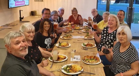
Most of you will have seen the amount of food that is presented to the groups for afternoon nibbles. At times the amount is overwhelming, and I get into strife for eating too much and then not being able to eat my dinner. To overcome this “problem” a roster was created so that only one couple was responsible for each day’s nibbles.
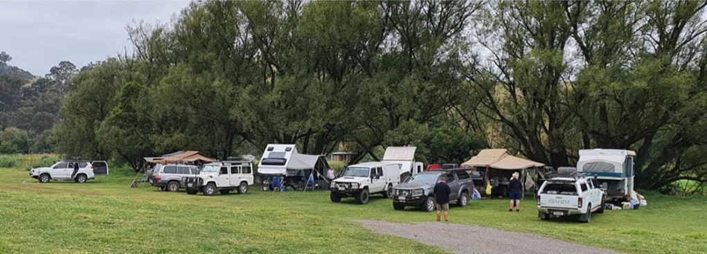
Because of the nature of the trip, it was limited to a maximum of six vehicles.
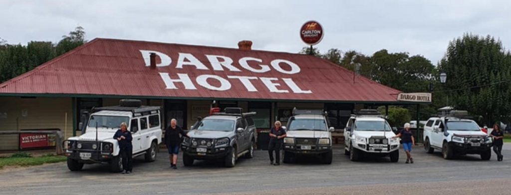
The participants were –
Michele and Jim C driving a Nissan Navara, towing a Kimberly Kamper,
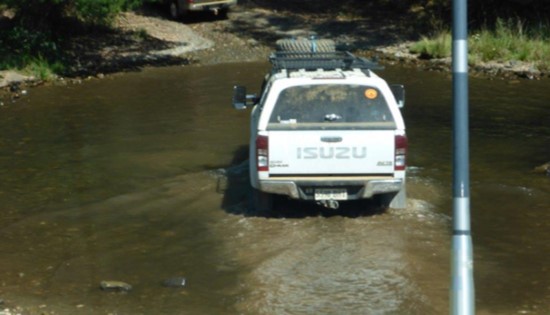
Maria and Greg D driving an Isuzu D-Max, towing a small Jayco poptop,
Cecilia and Alan L driving a Prado, towing a Cub Camper,
Maria and Steve N driving their modified 79 series Landcruiser dual cab, towing a Vista hybrid,
Val and Steve P driving their Landrover Defender, towing a small A Van,
Barbara and myself driving our 100 Series Landcruiser, towing our Kimberly Kamper.
Everybody got the chance to be daily leader and tail.
The overall distance covered by Barbara and me was 3610 km, Adelaide to Adelaide.
Friday 12/3/2021, Day 1 – by Michele

Four vehicles met at the Mt Osborne truck stop. Val and Steve had decided to stock up on fruit and vegetables at Bordertown because their home is inside of the current fruit fly area and Maria and Steve decided to take a few days extra to travel across and would meet us in Porepunkah. Everybody arrived early, so we got away just after 8:00 am.
Most of the day was spent in our vehicles. We had a quick lunch break in Tolmer Park at Bordertown and, with good planning and surprise, surprise, there was a very nice bakery.
We meet Val & Steve and we continued to our overnight, free campsite in the Kara Kara National Park at the Teddington Reservoir camp site. Great free camp with flushing toilets. Well worth a visit.
Our first evening was spent telling stories in a camp circle – it was too warm for a fire. Great first day.
Day’s run – 543 km.
Saturday 13/03/2021, Day 2 – by Maria D
We were all up and ready way before the scheduled start time of 9:00am and after some discussions about GPS’s, Val and Steve took the lead for our day’s adventures. We headed towards Bendigo where we made our first stop at the bakery in Kangaroo Flat (Kangaroo Flat used to be a town a couple of km from Bendigo but Bendigo has grown and absorbed it.) Some of us bought lunch at the bakery and others took advantage of the local IGA.
The weather was humid, and we pressed on through the numerous towns. We made a mental note to return to some of them for a longer visit.
The last petrol and comfort stop was at Euroa and from there we travel to our overnight campsite, Riverview Caravan Park in Porepunkah. Here we meet the final members of our group, Maria and Steve. After setting up our camps and making use of the shower block, we all gathered for nibbles in one of the shelter sheds because it started to rain!
Dinner that night was at the Porepunkah pub.
Day’s run – 411.5 km
Sunday 14/3/2021, Day 3 – Cecilia and Trevor
After a night with steady drizzle, we woke to a blue sky – so most canvas dried out. A leisurely start with some folk exploring Bright.
There is an interesting display outside of the Bright library – a bench flanked by stone ‘books’ commemorating 150 years of Bright.
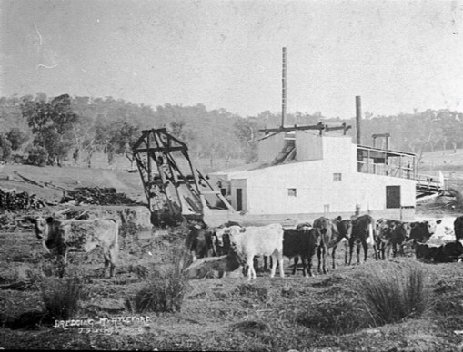
In the late 1800’s and early 1900’s Bright was the centre of major gold mining area. There are photos of gold dredges that created their own water channels up to a kilometre from the main river channel.
After fuelling up we started the drive to our next destination, the iconic hamlet of Dargo. Such was the desire to get there we even forgo the pleasures of the Harrietville bakery. (Damn! T.)
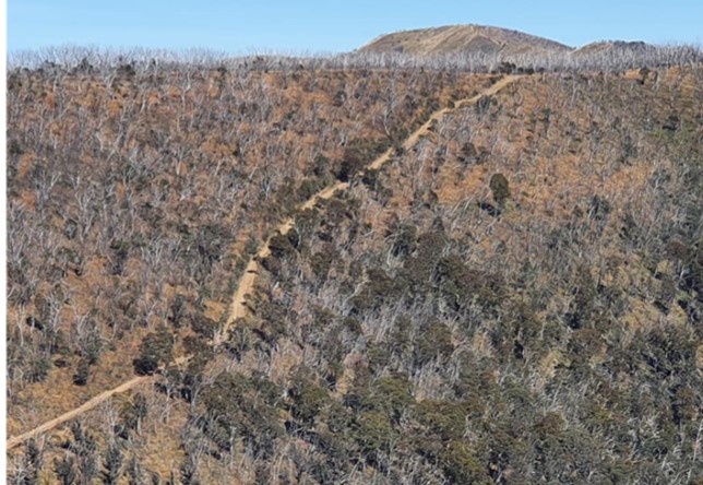
The first half of the drive to Dargo is along the steep Great Alpine Road. At the top of the range, you take a right turn on to Dargo High Plains Road. If you continue along the Great Alpine Road for a few more kilometres you go through the Mt Hotham ski village and, eventually, end up in Omeo and Bairnsdale. The Dargo Road immediately became a VERY steep, downhill dirt road which meant an air down of the tyres.

The view across the valleys were quite breath taking. Many trees were dead or dying. It seems that there are two main culprits. The bush fires that have decimated the area and a far more insidious problem, a native beetle that is attacking and killing these majestic trees – a native wood borer (Phoracantha sp) known as a longicorn beetle.
The last and even steeper 20 km down into Dargo is bitumen.
At 18km from Dargo, Cecilia and Alan’s Prado pulled over and stopped. It took a considerable amount of time for somebody to alight. (It was that long, that Barbara and I {Trevor} started to worry that there might have been a major health issue). Barbara and Trevor, and Steve and Maria pulled over to see what the problem was. The description Alan gave was, “The engine just stopped!” By this time, all of the remaindering travellers did U turns and came back to assist.
After a many false starts and, with the use of a multi-meter, it was determined that the battery had carked it and the engine management computer had switched everything off, to the extent that it would not allow the vehicle to start. We tried a second battery and that was flat as well. Note to one’s self, always ensure that all batteries are fully charged at all times.
As there was nothing that could be accomplished on the side of the road and it was an automatic vehicle which therefore should not be towed, and the road down to
Dargo was incredible steep where towing a dead vehicle without working power brakes which was in turn towing a camper trailer, would be bloody dangerous, it was decide the professional help was required.
Unfortunately, there was no phone coverage in the area. Steve and Maria volunteered to stay with Cecilia and Alan while the rest of the crew drove down to Dargo where there was phone coverage, so a rescue could be organised. A call to the RACV via the RAA and a tow truck was arranged from Bairnsdale, 100 km away. After arranging the tow truck, a couple of us drove the 18 km back to the stricken vehicle to let them know that recovery had been organised and was 1 ½ hrs away. The tow truck duly turned up and loaded the Prado and took their camper under tow.
Alan and Cecilia had two night stay in the Bairnsdale Caravan Park and returned to Dargo on Tuesday morning with a new battery and a new alternator. Seems that the alternator was the main culprit and when it stopped charging the battery, took up the load until it was drained. Because the battery voltage went so low it damaged the battery to the extent that it was un-recoverable. Thank goodness for RAA Premium!
The decision to not tow the dead vehicle to Dargo proved to be the correct one – we would have had to remove the tail shaft to prevent damage to the gear box. When all the vehicles arrived in Dargo, after negotiation the incredibly steep down ward section, the smell of overheated brakes was noticeable. Everybody had come down in first gear but that still was not low enough to hold the speed to a safe level, hence the use of the brakes.
Day’s run 166 km; max altitude 5400 ft.
Monday 15/3/21 Day 4 Dargo – by Maria N, Barbara and Trevor
The campground at Dargo is behind the pub. The trees dropped a horrible gum which stuck to everything!
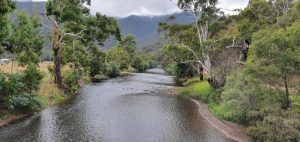
It is a beautiful spot with a little river, or brook, babbling away as the water flows past. The breeze is cool but the sun is hot; it is misty in the mornings.
There were 6 cars – and now there are 5.
As previously stated, Alan and Cecilia had trouble with their alternator so were towed to Bairnsdale for a couple of days. We left Dargo shortly after 9 and drove back up the track to the spot we had morning tea yesterday. We stopped at the start of the Blue Rag Track and had morning tea around 11am. So basically, we had ‘elevenzes”. Since Blue Rag Track is steep and narrow, we decided to put on the rear recovery hitch. Unfortunately, Steve left his towbar recovery hitch pin back in Dargo. Deciding caution was the better part of valour, Steve made the decision to return to Dargo to find the wayward device. So, then there were 4.
The rest of this report is by Barbara and Trevor.
There are two tracks in the Hi-Country that are only talked about around a campfire on cold, dark, moonless, windy nights with the gum trees moaning in the wind, while consuming a bottle of Stone’s Green Ginger wine. These are Blue Rag and Billy Goat Bluff. We were about to tackle Blue Rag.
Blue Rag Track is 17k’s each way (it’s an out and back); took 1 ½ hours each way to complete. There were some very steep in climbs which necessitated L2 and some right boot.
The top of the track is the Blue Rag Trig point. Here we found a marquee set up with hot drinks and food. Unfortunately, it turned out to be for a group of motorbike trail riders!
We stopped for the obligatory photos and tried to con some refreshments but the two blokes manning the facility would have nothing of it. Selfish, I reckon!
We continued on down from the Trig point to the river where the track stops.
Here we had lunch and contemplated the trip out. Some of the corners were a bit hairy and narrow, and going down some sections were very steep, needing L1 and some brake/throttle modulation. After reaching the main road back to Dargo, the group stopped at a memorial grave to The Early Women in the High Country.
It was then time to head home for nibbles, showers and tea at the Dargo Pub.
That’s one of the iconic tracks in the bag.
Day’s run 149 kms; max altitude – 5650 ft.
Tuesday 16/3/21 Day 5 – by Val
Enjoyable dinner at the Dargo Pub last evening followed by joyous laughter and jokes around the fire. After a cold night, the previous night had been quite mild, we woke to overcast skies but no rain. Cecilia and Alan had left Bairnsdale at the crack of dawn so re-joined us early. A new battery and alternator. Steve and Val were delegated to lead what was, apparently, Ladies Day. The decision had been made to explore the Historic Mining area near Dargo; on arrival at the gravel road we reduced the air in our tyres. Steve and Maria, unfortunately, decided to return to camp due to the transmission temperature warning light coming on the Toyota. With only a map, we set off to explore. At our first site, Bee site 51, there was no evidence of ruins but we went into the bush to check. It turns out it was Bee site 51, and led to bee hives. A good start – but onward. We came across Grant’s cemetery with two headstoned grave sites. They did not have long lives – aged 64 and 48.

A little alteration to the plaque at the cemetery entrance using “duck tape,” made for a good photo.
At the Grant Township site, the ruins signs informed about the Pioneer Hotel, Sharebrokers office and the Dargo Goldfields.
On our merry way, we drove the long, winding, rocky road descent to the old township site of Talbotville. Now, it is Green Flat campsite with a long drop. The Mitsubishi Club of Queensland were camping here, spending 22 days in the High Country. An exchange of track information took place, as they had done Billy Goat Track the previous day.
We exited the campground via an easy creek crossing to climb to Mad Dog lookout.
We climbed and climbed but could not find the lookout. Onward and upwards we continued, through the Tea Tree Range, reaching 1512m, before winding our way down, around, then up and around to eventually re-join the Dargo High Plains Road. Our roads were gravel and not challenging, but some steep drops. The Alpine fire damage was as far as the eye could see. The joy of two creek crossings made reaching the bottom appealing as we were fully aware that another long windy climb was ahead. Weather again was perfect once the sun broke through mid-morning.
Unfortunately, on our return to camp, Steve and Maria had left for home to get their vehicle seen to.
Day’s run – 136 km; max Altitude 4920 ft
Wednesday, 17/3/21 Day 6 – by Barb
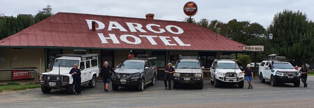
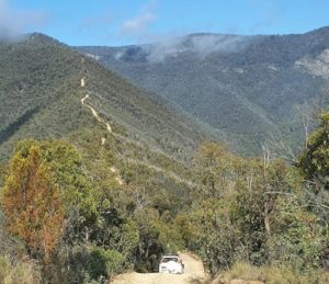
After a mild night we were woken up by the birds in time for the 9.00 start. Today we were going to do the iconic Billy Goat Bluff Track. For the first time in three mornings, there was no one parked outside of the Pub so we lined up the vehicles for the traditional photo outside the Dargo Pub. The start of Billy Goat is 25 km from Dargo and involves driving through the picturesque Wonnagatta Valley.
After the 25 km drive through the Valley we reached the bottom of Billy Goat where we let our tyres down little more (in our case from dirt road pressure of 25 psi to rock climbing 20 psi. T.) By reducing the pressure, it is easier for the tyres to deform and gain traction as you climb up and over the rocks.
This was a long, slow, steep at times, rough drive, using low range, 4wd and diff locker occasionally. We gained 3762 ft (1147 m) in altitude in just a 10 km climb.
Greg was having a problem – he couldn’t engage 4wd, so Steve assisted by winching and then helping him through tricky bits. As they were on a very step section of the track and we could not turn around, there was no way any of us could go back to help. That did not sit well because we all had the desire to go back to assist.
While we were waiting for Greg to overcome his problems, we heard a person come over the UHF – “I am travelling alone. Can I make it up Billy Goat?” After a bit of questioning, it was determined that he was driving a Triton ute which he had had for three months, with virtually no 4wd experience. He was running highway tyres but he did have, “A heavy duty winch which cost me a lot!!” BUT no other recovery equipment or tyre gauge or compressor.
We advised him not to attempt the track. He then became most insistent that he was going to and would we be able to help him if he got stuck. We told him in no uncertain terms that we would not and, indeed, could not help him in any way. His parting comment was, “Well, I am going to do it and if I get into trouble I will ring the RACV and they will help me.” That was the last we heard from him but the whole conversation took around 15 minutes.
Some muvvers do have em!
Lunch at the Pinnacles where we met Andy, who tagged along with us back to Dargo. Travelled through interesting tracks and forests with many tree ferns. At one stage we took a track that appeared on some maps but not on others. Needless to say it was a dead end. I think some map makers have a perverted sense of humour. A very interesting day.
Arrived back in Dargo ready to fuel up for tomorrow’s transit to Knockwood. Dinner at the Pub as Alan and Cecelia hadn’t been there. To do all of the tracks and visit all of the historical sites around Dargo would take several weeks.
Day’s run, 122 km; Max altitude gained – 4572 ft
Thursday, 18/3/21 Day 7 – by Michele
Today was a transit from Dargo to our next camp site – a free camp called Knockwood on the Woods Point to Jamison Road. We had a misty start to our morning and a damp pack up where several field mice decided to sleep in my camp chair.
After leaving Dargo at 9.00am, our group travelled via the back blocks – skirted Stratford, Maffra, Heyfield and Cowwarr, where the town had painted and decorated 44 gallon drums – cow statues – they were very artistic.
We lunched in Rawson and then travelled on past Thompson Dam – the road goes across the Dam wall!! There were miles of magnificent tree ferns around here. Once we got down in the valley we drove through a very quaint town called Woods Point, the service station still had “Golden Fleece” petrol signs!
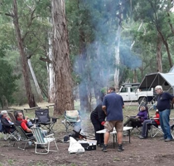
We arrived into Knockwood campground at 4.30 pm and were sitting around the camp fire by 6.00 pm with nibbles. We all settled down to the roaring fire, with firewood expertly split by Steve P. Our peaceful night was interrupted by a National Parks search and rescue exercise.
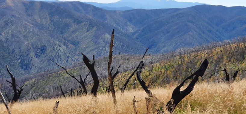
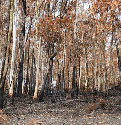
On the way we passed through large area that had recently been burnt out by a bush fire.
Day’s Run 270 km; Max altitude gained – 3900 ft
Friday 19/3/21 Day 8 – Maria D
Today we started our day’s driving by going to the village of Jamieson for fuel and some supplies. Steve and Val didn’t join us as they were headed to Mansfield to get a battery.
After filling the vehicles, dumping some rubbish and exploring the village we left Jamieson and made our way to the start of the Mt. Terrible track. We had planned to tackle this one from the opposite end but the burn-off prevented that.
After about 5 km there was that dreaded sign, “Road Closed – Fire Burn Off.” So a quick U turn back to Fryers Creek Rd which turned out to be a picturesque and, occasionally, challenging track that took us back to the bitumen. As we were close to lunch time it was decided that we would head back to camp for a feed and, on the way, do the Flour Bag track. When we started up Flour Bag we were met by a vehicle coming down and the driver told us that the track was closed for a fire burn off. Seems that the whole mountain to the east of our camp at Knockwood and all of the tracks were closed for burn off. So back to camp for an early lunch and a decision on what to do for the afternoon.
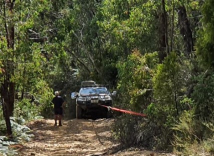
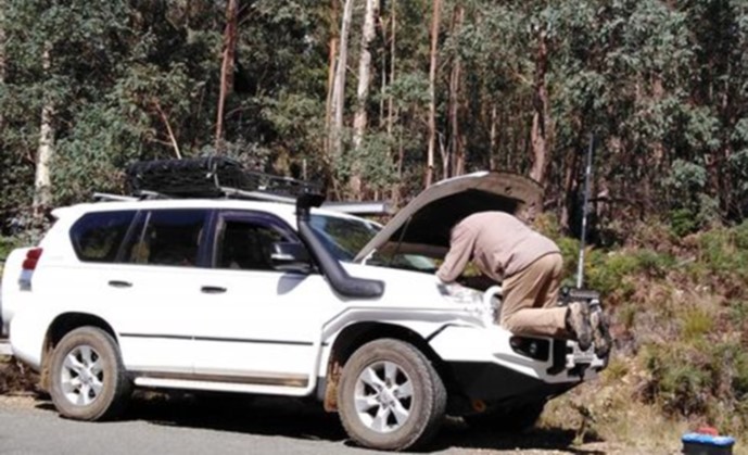
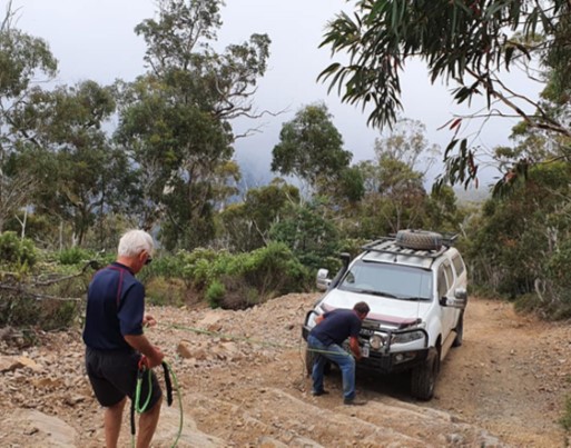
The German Spur track was our selection for the afternoon drive and, although steep, we were travelling well (even Greg and Maria with 2wd only) and nearly to the top, when Greg and Maria got stuck and couldn’t move. Maria was out of the car as it was sideways on the track. She nearly died walking up the remaining steep climb! Trevor and Alan gave assistance with the setting up of the recovery gear.
(Note – the photo shows the preparation for the winch – the air dampener is not yet in place and Trevor has not yet gone to a safe distance from the vehicle.)
Greg was eventually winched up to the top, after an hour. Our next stop was Woods Point but as it was getting late we decided to call it quits and head back to camp for a ‘brown lemonade’ or two. Thanks to everyone that helped us.
Day’s run – 143 Km; Max altitude 3641 ft; Steepest climb 2100 ft (670 m) in 5 km
Saturday 20/3/21 Day 9 – by Cecilia
Day Leaders: Val and Steve
After a mild night, we were on the road by around 9 am, travelling first to Jamieson on dirt tracks. We were “tail end Charlie”. A lovely sunny day, with clear air, after the previous smoky day. We did see several fire appliances heading towards Knockwood. We saw fire people stopped along the road doing tidy ups etc, noticed smoke in the distance as burns still happening. Left Jamieson on the Licola Road – beautiful rolling hills – easy road – we were by now travelling through Jamieson State Forest. Morning tea was off the side of the road and then we travelled on.
Extremely foggy very quickly, and it got extremely cold. We were up at 5000 ft, and rocky terrain. This road is closed in winter because of snow.
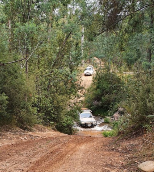
Val insisted we couldn’t stop at the “scenic view” stops – just cos we couldn’t see ANYTHING! Fog had cleared by the time we came onto the Lazarini Spur Track – some firewood was acquired. We stayed on this track as it was a “short cut”, but proved to be longer, as there were lots of tricky bumpy spots and river/creek crossings.
The Lazarini Track ends across the road from the Knockwood camp ground. As it was still quite early, several couples decided to visit the village of Woods Point which we had passed through on the way to Knockwood.
The decision was made, due to anticipated poor weather, to move camp tomorrow, so some folk have been packing up. Quiet afternoon relaxing, ready for “drinkies”.
The tracks have been quite challenging for us “newbies” to the High Country. We have learnt a lot from those more experienced members of the group, so we are very grateful to be travelling with them!
Day’s run – 112 km; Max altitude – 5220 ft (Mt Skene 1570 m); Steepest decent – 759 m (2490 ft) in 12 km
Sunday 21/3/21 Day 10 – by Val
Drizzle on and off overnight so damp pack up for our trip to Mansfield and then on to our next free camp at Sheep Yard Flat. Still smoke in the area from the planned burn off which we were told was the biggest burn off for a long time. Drive to Mansfield was easy and drizzle eased. We all had free time in Mansfield for a few hours to restock and wander (lots of bakeries!). Unfortunately, as it was Sunday, there were no 4WD accessory shops open so Steve and Val could not purchase a new DC to DC converter for the van. Some took the opportunity to visit the laundromat and the toilet dump point. Drizzle on and off for the whole day.
We finally gathered in the rain under a very small veranda before our short trip up the Mt Buller Road and then down the Howqua River Road to Sheepyard Flat, on the Howqua River, for our final camp site for the trip.
Days run 110 km.
Monday 22/3/21 Day 11 – by Barbara
Set off at 9.00 for Craig’s Hut. Because there were some quite difficult sections of track to be negotiated today Greg and Maria went with Alan and Cecilia because they could still not select 4WD . No more than 100 m out of camp we had to do a U turn. Our leader for the day, Trevor, had missed the turn to Doughertys Track. The climb up to the Mt Buller Rd was scenic but not really challenging. After couple of km on the bitumen of the Mt Buller Road, we turned off onto the dirt, but excellent, Mt Stirling Rd which, in turn, led to the Circuit Rd. These roads are made for conventional 2wd vehicles so there were no dramas.

We had stopped at a clearing for morning tea when a Landcruiser skidded to stop in the middle of the road. A long haired bloke (turned out to be a relatively well-known country music singer, Kevin Sullivan) lent out of the window to inform us that he and a couple of others were videoing at Craig’s Hut with Charlie Lovitt, the head horse wrangler from “The Man from Snowy River” films. They took off in a cloud of dust while we finished our morning tea.
People in conventional 2WD vehicles have to park 1.5 km from Craig’s Hut and walk in. Those of us with 4WD can take a ‘proper’ 4WD Only track to within 200m of the Hut. Really good for Old F..ts with dicky knees and crook hips.
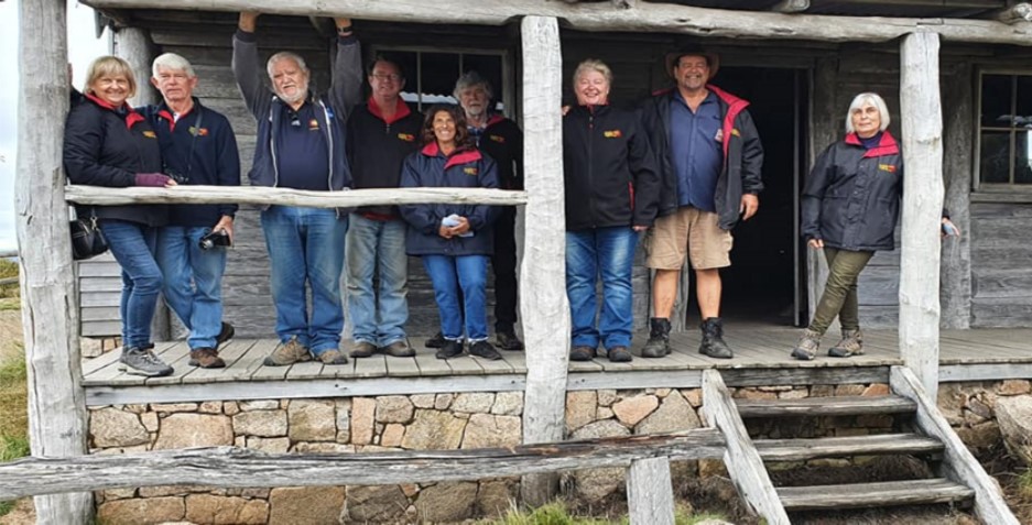
We arrived at the Hut to find the country entertainers had started their video shoot. A few of the Club members had their photos taken with Kevin and Charlie.
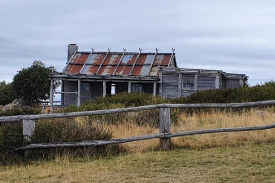
Craig’s Hut was originally a set from the “Man from Snowy River” 1982 film. The current one is the fourth version. Version three burnt down in 2006 and the hut was rebuilt in 2007.
(No high country person in their right mind would build a hut on a high, wind swept, plateau. This is really just a tourist thing. T.)
We had lunch in the shelter shed at the hut (it was cold and drizzling) and then back to the vehicles to do The Monument Track. The last time we had been here this was one of the roughest tracks we had negotiated. Fortunately it had been graded some time recently. This track leads down to the really pretty Bindaree Falls.
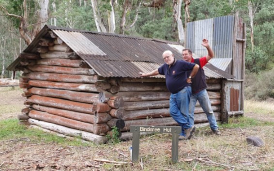
After a short walk to the falls and back, we ventured on to Bindaree Hut. From here we traversed the 16 Mile Jeep Track which had some ‘technical’ challenges, dropped into Pike’s Shed for a look (and found some bullet holes in one of the walls), then on and up to the 2WD Bluff Link Road which took us to Brocks Road and ‘home’.
Day’s Run – 115 kms; Max altitude – 5339 ft.
Tuesday 23/3/21 Day 12 – by Michele
A very wet night and each campsite awoke to its own moat. We had ducks with ducklings wandering around finding grubs and bugs to eat. As the tracks were too wet most of us decided to drive up to Mt Buller for coffee. The drive was misty and wet but still very beautiful. We found one coffee shop open “The Whitt” but only 2 people were allowed inside at a time so we found a balcony to huddle under and enjoy our coffee.
Then down to Mansfield for some of the convoy to have a very nice meal at the Mansfield Pub, some decided to go to the Isuzu Dealer for diagnostic info and others to go in search of a new DCtoDC converter for their van.

Our trip back to camp was on a very muddy and slippery track. Fortunately the campground had drained during the day but everything was still very damp. Our evening nibbles were held under the Burford’s awning in the rain – then over to the campfire – in the rain!!!
Trevor Burford managed some site excavations and drained his campsite moat!! Rainwater was collected during the day to top up jerry cans. Steve Plowman managed to buy a fancy new Redarc DCtoDC converter and upon fitting, found that the old one was ok but a fuse was blown!! Bugger!!
Days Run 133km; Maximum altitude – 5527 ft
Wednesday 24/3/21 Day 13 – by Maria
After the heavy rain over the last couple of days and the predicted heavy rain for the day as well, it was decided that the tracks would be too dangerous to venture upon them. So a trip to the Eildon Dam and then around to Boonie Doon (of The Castle fame) was planned. It was also decided that because all of the tracks were a wash out there was really no point in staying for the extra day, so we would leave early. Because we are leaving a day early – we are doing today’s report!
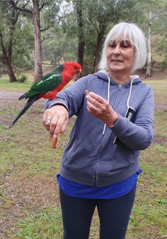
Wet night, not much heavy rain, but enough to keep everything damp. Just before we left, we were visited by some rather beautiful male King Parrots, who came down and sat on the cars. Some were brave enough to sit on my arm and Jim’s hat.
On the road, dirt tracks, away from camp, headed off on the road to Merrijig, with Howqua Hills to our right. Travelling through beautiful farm land, with crops, sheep and cattle (some stopped when they saw a marker for a St. Patrick’s long gone!)
We stopped at Paradise Lookout for morning tea, then travelled on, with misty skies, to Eildon Dam, which is one of Victoria’s most popular freshwater, fishing spots, stocked by Fisheries Vic. It is also the only Vic Reservoir where you will find houseboats and cabin cruisers.
We travelled back across the bridge to have lunch at a park. Trevor and Barbara visited the Info Centre and got a more detailed map of the area – Thank you!!
After lunch we headed towards Bonnie Doon and continued on tracks towards the bitumen and Mansfield. On the way, we stopped to visit a War Memorial that Val had spotted earlier in the week. It was quite simple, and easy to miss, but paid respect through stone plaques for each war Australian troops have been a part of.
Once back at the campsite, the lads went off to find some firewood – they also found a heavy shower of rain – that we did NOT have, only a short while down the road. The pattern of nibbles, dinner round the fire continued – without being rained out! A pleasant day’s travel.
Days Run 222km Maximum altitude – 2857 ft
The original plan was for the trip to finish on the Friday but, due to the heavy rain and more rain forecast, it was decided to finish the trip a day early. Barbara and Trevor were to head straight home while the rest of the group headed for Echuca to have a look at the silo art around the area.
It was a fantastic trip, to an incredible part of Australia.
Photos courtesy of Maria, Michele, Cecilia and Steve.